Monthly Construction Aerial Progression & Jobsite Monitoring in Las Vegas, NV
General contractors, commercial developers, project executives, and construction lenders across Las Vegas, Henderson, North Las Vegas, and Clark County rely on Echo Point Aero for automated, repeatable aerial progress documentation, Procore-integrated jobsite records, and construction draw request verification.
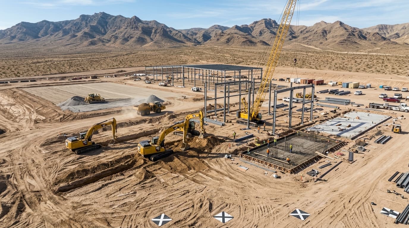
Locked GPS coordinates, altitude, and camera angles flown identically every single month.
Crystal-clear resolution capturing steel framing, rebar spacing, MEP, and site utilities.
Fast cloud delivery ready for monthly pay-application meetings and owner presentations.
Full comprehensive coverage satisfying all tier-1 general contractor safety requirements.
Why Ground Photos & Static Jobsite Cameras Leave Critical Blind Spots
Incomplete Jobsite Records & Delayed Monthly Pay Applications
Static jobsite pole cameras provide narrow, fixed-angle views easily blocked by cranes, delivery trucks, and rising structural walls. Meanwhile, manual ground walks by project engineers miss overarching sitework, perimeter trenching, and roof decking progress. When lenders and out-of-state equity partners request visual verification for multimillion-dollar draw requests, inconsistent photos cause disputes and payment delays.
Automated GPS Waypoint Trajectories & Orthomosaic Milestones
Echo Point Aero programs repeatable autonomous GPS flight paths that capture your jobsite from the exact same spatial coordinates, headings, and camera tilts on a scheduled weekly, bi-weekly, or monthly cadence. We deliver time-lapse flyovers, 360° interactive aerial panoramas, and high-resolution overhead orthomosaics that plug seamlessly into Procore, Autodesk Construction Cloud, and Bluebeam.
Engineering-Grade Deliverables & Field Capabilities
Each mission is custom-engineered for rapid integration into commercial construction, civil engineering, and facility management workflows.
Repeatable GPS Waypoint Flight Trajectories
Autonomous flight plans locked to exact GPS coordinates ensuring seamless month-over-month progression comparison.
- ✓Flies identical elevation, gimbal pitch, and camera focal length on every flight cycle.
- ✓Produces seamless side-by-side progression sliders and high-impact 4K time-lapse marketing videos.
- ✓Captures cardinal-direction obliques (North, South, East, West) and 360° orbital sweeps of the jobsite.
- ✓Provides out-of-state owners, investors, and joint-venture partners with transparent executive visibility.
Construction Draw Request Verification for Lenders
Indisputable, time-stamped visual proof of completed construction milestones to accelerate pay applications.
- ✓Documented visual proof of completed grading, mass excavation, foundation pours, and structural steel erection.
- ✓Verifies mechanical, electrical, and plumbing (MEP) rough-ins and exterior building envelope dry-in.
- ✓Accelerates monthly draw approvals and reduces bank inspection friction.
- ✓Creates a permanent chronological archive to defend against subcontractor delay claims and change order disputes.
Procore, Bluebeam & Autodesk Construction Cloud Sync
Formatted aerial assets organized and delivered directly into your existing project management software.
- ✓Direct upload into Procore Photos, Documents, and Drawings directories.
- ✓High-resolution PDF and image exports formatted for Bluebeam Revu markups and site logistics meetings.
- ✓Interactive 360° spherical panoramas allowing virtual walk-arounds for remote project teams.
- ✓Sub-inch orthomosaic map layers aligned to architectural plan sheets for clash detection.
Site Logistics, Laydown & Safety Compliance Audits
Comprehensive overhead views helping superintendents optimize traffic flow, crane positioning, and material laydown.
- ✓Identify staging bottlenecks, haul road conditions, and crane radius clearances.
- ✓Monitor stormwater pollution prevention plan (SWPPP) compliance, perimeter silt fencing, and dust control.
- ✓Verify perimeter fencing, security lighting, and OSHA safety compliance across the entire site perimeter.
- ✓Review subcontractor staging areas and material inventory to coordinate scheduled deliveries.
Deployment & Quality Control Protocol
From initial airspace clearing to final stamped deliverables, our protocol ensures 100% regulatory compliance, safety, and sub-centimeter repeatability.
Site Onboarding & Waypoint Programming
Coordinate with superintendent to program permanent flight waypoints and safe landing zones.
During the initial baseline flight, our pilot establishes recurring GPS waypoints, high-definition orbital vectors, and LAANC airspace authorizations for the project lifecycle.
Recurring Scheduled Flight Execution
Autonomous execution on weekly, bi-weekly, or monthly intervals.
Our Part 107 pilots arrive on site during active daylight or scheduled work shifts, executing repeatable flight routines with zero interference to ground trades or equipment.
Quality Control, Color Grading & Ortho Stitching
Professional color grading, horizon leveling, and photogrammetric stitching.
All 4K video clips, high-resolution obliques, 360° panoramas, and nadir orthomosaics are processed, metadata-tagged, and organized by milestone.
Cloud Portal Delivery & Direct Procore Upload
Delivered within 24 to 48 hours for immediate distribution.
Project stakeholders receive an email notification with access to a dedicated cloud portal, downloadable full-resolution packages, and direct Procore/Bluebeam sync.
Enterprise Flight System Specifications
| Domain / Category | Specification Parameter | Certified Performance / Standard |
|---|---|---|
| Image Sensor | Resolution & Sensor | 1/1.3" CMOS 48MP High-Resolution Aerial Photography |
| Video Capture | Cinematic Progress | 4K UHD at 60 fps (H.265, 10-bit D-Log M for color grading) |
| Waypoint System | Flight Repeatability | Centimeter-Level RTK / GPS Trajectory Waypoint Guidance |
| Turnaround SLA | Delivery Speed | Standard 24–48 Hours / Expedited Same-Day Available |
| Integrations | Project Management | Procore, Autodesk Construction Cloud, Bluebeam Revu, Box, Google Drive |
| Compliance & Safety | FAA & OSHA Standards | 14 CFR Part 107 Certified, OSHA-10 Safety Card Holders, PPE Compliant |
| Insurance | Aviation Liability | $5,000,000 Commercial Aviation Liability Certificate of Insurance (COI) |
Answers for Facility Managers & Project Executives
How do your repeatable GPS waypoint flights maintain identical angles every month?+
Can you upload photos and orthomosaics directly into our company's Procore account?+
How does aerial progression documentation help with construction draw requests?+
What safety protocols and jobsite insurance do your pilots carry in Clark County?+
Ready to Deploy Over Your Southern Nevada Site?
Speak directly with our operations dispatch desk to coordinate FAA Part 107 airspace authorizations, night waivers, and survey schedules across Clark County.