Commercial Drone Mapping, Orthomosaic Surveys & 3D LiDAR in Las Vegas, NV
Echo Point Aero delivers turnkey commercial drone mapping, high-density 3D LiDAR, and survey-grade orthomosaic surveys for civil engineering firms, land developers, earthwork grading contractors, and aggregate quarries across Las Vegas, Henderson, North Las Vegas, Summerlin, Apex, and Southern Nevada.
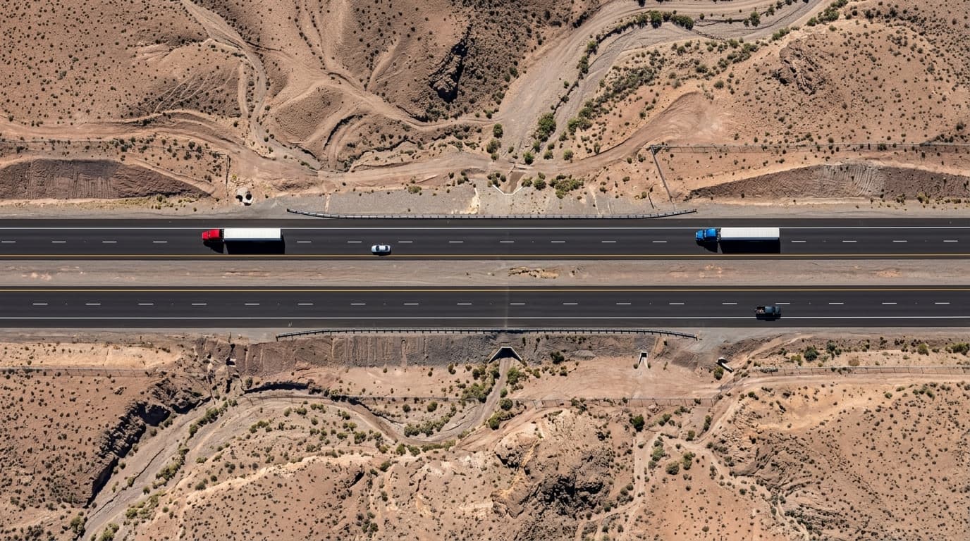
Sub-inch spatial resolution capturing ultra-fine grade boundaries, utility marks, and curbs.
Survey-grade precision verified against surveyed Ground Control Points (GCPs).
High-efficiency enterprise aerial platforms covering massive civil corridors in hours.
Rapid delivery of georeferenced GeoTIFFs, LAS point clouds, and CAD surface TINs.
Replacing Weeks of Manual Ground Staking with Survey-Grade Aerial Photogrammetry
The High Cost & Delay of Manual Topographic Ground Surveys
Traditional ground survey crews carrying rover rods across 50 to 500-acre raw desert parcels in Clark County take weeks to establish spot elevations. Heavy earthwork equipment, dangerous caliche trenching, steep wash ravines, and active haul trucks create severe safety risks while delaying civil engineering grading approvals and earthwork draw requests.
RTK/PPK Aerial Photogrammetry & Dense 3D LiDAR
Echo Point Aero deploys enterprise RTK/PPK aircraft equipped with mechanical shutter sensors and LiDAR scanners. In a single morning, we capture millions of georeferenced elevation points across your entire site, generating 0.5-ft topographic contours, Digital Terrain Models (DTM), and CAD-ready Civil 3D surfaces aligned directly to the Nevada State Plane coordinate system.
Engineering-Grade Deliverables & Field Capabilities
Each mission is custom-engineered for rapid integration into commercial construction, civil engineering, and facility management workflows.
2D Georeferenced Orthomosaics (GeoTIFF)
Survey-grade 2D orthomosaic imagery corrected for optical lens distortion and terrain relief elevation.
- ✓Calibrated with on-site RTK base stations and permanent Clark County benchmark control.
- ✓Sub-inch GSD resolution allows clear inspection of utilities, striping, boundary monuments, and grading cut stakes.
- ✓Exportable in standard GeoTIFF format aligned to NAD83 Nevada East State Plane (FIPS 2701) and NAVD88 orthometric heights.
- ✓Direct overlay into AutoCAD Civil 3D, Bentley MicroStation, ArcGIS, and Bluebeam.
3D LiDAR & Digital Surface Models (DSM/DTM)
Dense 3D point cloud generation penetrating desert scrub and vegetation to expose bare-earth topography.
- ✓Millions of high-density 3D points capturing true elevations across steep desert washes, bluffs, and rocky outcroppings.
- ✓Ground-classified point cloud filtering (.LAS/.LAZ) stripping vegetation and temporary equipment.
- ✓Digital Terrain Models (DTM) and bare-earth Digital Elevation Models (DEM) ready for hydraulic modeling.
- ✓Generates 0.5-foot and 1-foot engineering elevation contours ready for grading plan overlay.
Volumetric Cut/Fill & Stockpile Audits
Fast, accurate volume calculations for aggregate quarries, earthwork grading, and structural fill reconciliation.
- ✓Calculates exact cut and fill yardage against proposed finish-grade design TIN surfaces.
- ✓Measures raw material stockpiles (gravel, sand, base, asphalt, soil) with ±1–2% volume accuracy.
- ✓Color-coded cut/fill heatmaps illustrating high and low grading zones across the jobsite.
- ✓Provides independent third-party volume reports to reconcile contractor hauling invoices and avoid billing disputes.
CAD, Civil 3D & GIS File Integration
Engineering-grade data delivery formats tailored specifically for civil design teams and GIS coordinators.
- ✓Native DWG, DXF, LandXML, and GeoTIFF file packages ready for immediate import.
- ✓Pre-aligned coordinate projections avoiding geodetic shift errors or manual scale-factor adjustments.
- ✓Compatible with Autodesk Construction Cloud, Procore, and Bentley ProjectWise.
- ✓Secure cloud GIS download portal with shareable 3D web model viewer for non-CAD stakeholders.
Deployment & Quality Control Protocol
From initial airspace clearing to final stamped deliverables, our protocol ensures 100% regulatory compliance, safety, and sub-centimeter repeatability.
Flight Planning & Airspace Clearance
Boundary definition, GSD resolution targeting, and automated LAANC approval.
Our flight team analyzes property bounds, sets ground resolution parameters, and secures FAA Part 107 airspace authorizations across Clark County.
Ground Control Setup & RTK Flight Mission
Survey-grade ground control placement and autonomous multi-battery flight grid.
We deploy AeroPoints or survey-grade GNSS base stations to establish high-precision checkpoints before flying autonomous cross-hatch aerial grids with 75–80% overlap.
Photogrammetry & Point Cloud Reconstruction
Ray-tracing photogrammetric processing and bundle block adjustment.
Raw imagery is processed through state-of-the-art photogrammetry engines with ground control verification, generating densified point clouds, DSMs, and seamless orthomosaics.
QA/QC Quality Assurance & Deliverable Export
Rigorous root-mean-square error (RMSE) verification and file delivery in 24–48 hours.
Every project includes a comprehensive Quality Report documenting horizontal and vertical RMSE accuracy against independent checkpoints before final deliverable dispatch.
Enterprise Flight System Specifications
| Domain / Category | Specification Parameter | Certified Performance / Standard |
|---|---|---|
| Mapping Sensors | Camera & Optical System | 4/3" CMOS 20MP / 48MP Mechanical Shutter (No Motion Blur) |
| Positioning System | GNSS Technology | Multi-Band Real-Time Kinematic (RTK) & Post-Processed Kinematic (PPK) |
| Coordinate System | Geodetic Datums | NAD83 (2011) Nevada State Plane East (US Survey Feet), NAVD88 Geoid18 |
| Horizontal Accuracy | Absolute Precision | 1.0 – 2.0 cm (0.03 – 0.06 ft) verified against surveyed GCPs |
| Vertical Accuracy | Z-Axis Precision | 2.0 – 3.5 cm (0.06 – 0.11 ft) verified against surveyed GCPs |
| Deliverable Formats | Data Deliverables | GeoTIFF, LAS/LAZ Point Cloud, LandXML, DXF Contours, PDF QA Report |
| Insurance & Safety | Aviation COI | $5,000,000 Commercial Aviation Liability Certificate of Insurance (COI) |
Answers for Facility Managers & Project Executives
How accurate is commercial drone mapping compared to traditional land surveying in Nevada?+
Can Echo Point Aero drone survey data be imported directly into AutoCAD Civil 3D?+
How do volumetric cut/fill stockpile audits prevent contractor billing disputes?+
What is the typical turnaround time for a 50 to 200-acre site survey in Clark County?+
Ready to Deploy Over Your Southern Nevada Site?
Speak directly with our operations dispatch desk to coordinate FAA Part 107 airspace authorizations, night waivers, and survey schedules across Clark County.