FAA Part 107 Thermal Roof & Solar Drone Inspections in Las Vegas, NV
Commercial facility directors, industrial property managers, roofing consultants, and solar EPC O&M teams across Las Vegas, Henderson, North Las Vegas, and Clark County partner with Echo Point Aero for non-destructive radiometric roof moisture detection, solar string anomaly diagnostics, and stamped 24–48 hour thermographic engineering reports.
High-precision uncooled VOx radiometric microbolometer with NETD ≤ 50mK sensitivity.
Rapid non-destructive coverage with zero foot traffic on fragile TPO/EPDM membranes.
Targeted section repairs and wet insulation board replacement vs. full roof tear-off.
Fast delivery of radiometric RJPEG maps, CAD boundaries, and stamped PDF summaries.
Why Traditional Roof Walks & Visual Inspections Fail in Southern Nevada
Catastrophic Heat Trapping & Hidden Structural Rot
In the extreme Mojave Desert climate, rooftop temperatures regularly exceed 160°F. When moisture penetrates seams or punctures in TPO, EPDM, or built-up roofing (BUR), it gets trapped inside the underlying polyisocyanurate (polyiso) insulation. The intense heat causes this moisture to vaporize and condense in a continuous cycle, rotting the insulation board, dissolving adhesives, and oxidizing metal roof decks years before water visibly drips into your warehouse or casino resort.
Post-Sunset Radiometric Infrared Aerial Thermography
Echo Point Aero operates under an approved FAA 14 CFR § 107.29 Night Operations authorization. Flown 45 to 90 minutes after sunset during optimal solar loading dissipation, dry roofing material radiates heat and cools rapidly, while moisture-saturated insulation retains its thermal mass. Our 640x512 radiometric thermal sensors isolate exact temperature differentials (Delta-T), delivering a crystal-clear boundary map of moisture intrusion down to the individual insulation square.
Engineering-Grade Deliverables & Field Capabilities
Each mission is custom-engineered for rapid integration into commercial construction, civil engineering, and facility management workflows.
Commercial Flat Roof Moisture Mapping
Post-sunset radiometric infrared flight missions calibrated to isolate subsurface moisture entrapment across commercial, industrial, and institutional flat roofs.
- ✓Flown during optimal thermal capacitance dissipation windows under 14 CFR § 107.29 Night Waiver.
- ✓Pinpoints exact trapped moisture boundaries beneath TPO, PVC, EPDM, and multi-ply modified bitumen membranes.
- ✓Quantifies saturated square footage to substantiate warranty claims and enable targeted patching instead of full roof replacement.
- ✓Zero penetrations, zero core drilling damage, and zero foot traffic on fragile or aged membranes.
Commercial & Utility Solar PV Diagnostics
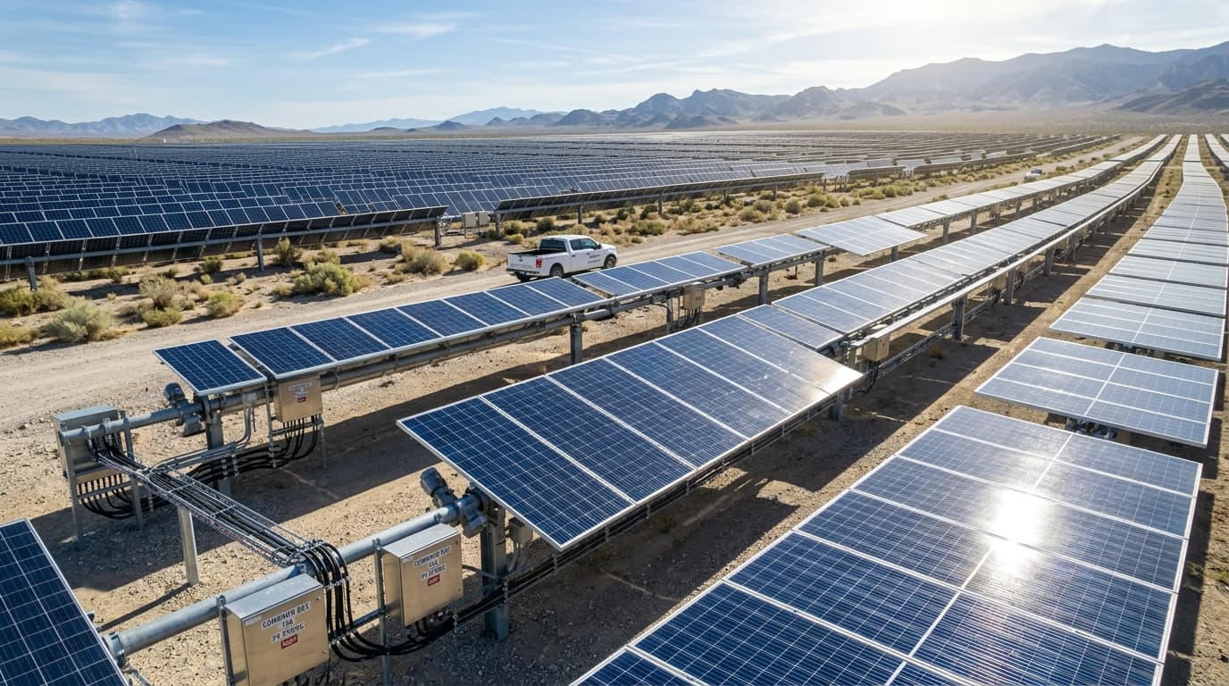
High-throughput thermographic scans of commercial rooftop arrays and utility-scale photovoltaic installations across Nevada.
- ✓Identifies cell hot spots, cracked silicon, bypass diode failures, PID (potential induced degradation), and delinquent string inverters.
- ✓Calibrated under global irradiance standards (>700 W/m²) for reliable thermal anomaly grading.
- ✓Delivers GPS panel-level georeferenced anomaly tables ready for field O&M punch list execution.
- ✓Prevents module thermal runaway, arcing risks, and millions of dollars in annual power generation loss.
Dual-Sensor Aligned RGB + Thermal Overlays
Pixel-perfect registration between ultra-high-resolution visual 48MP imagery and calibrated radiometric thermal orthomosaics.
- ✓Direct comparison between surface physical condition (ponding water, debris, mechanical damage) and subsurface thermal delamination.
- ✓Exportable in standard GIS formats: Georeferenced GeoTIFF, DXF moisture boundary vectors, and high-res orthomosaics.
- ✓Aligned to the Nevada State Plane coordinate system (NAD83 East Zone) for seamless import into Autodesk Civil 3D, Bluebeam, and Procore.
- ✓Accurately maps HVAC RTU curb seals, parapet flashing, scuppers, and expansion joint perimeters.
Building Envelope & Façade Thermal Audits
Comprehensive thermal assessments of exterior building envelopes, curtain walls, and industrial cold-storage facilities.
- ✓Identifies thermal bridging, missing insulation, and air leakage across multi-story commercial façades.
- ✓Scans high-rise resort towers and casino casino podiums safely without expensive swing stages or scaffolding.
- ✓Locates HVAC duct leakage and thermal loss across commercial rooftop mechanical penthouses.
- ✓Provides baseline energy audit documentation for LEED certification and building code compliance.
Deployment & Quality Control Protocol
From initial airspace clearing to final stamped deliverables, our protocol ensures 100% regulatory compliance, safety, and sub-centimeter repeatability.
Pre-Flight Engineering & LAANC Airspace Approval
Site review, digital flight-line programming, and FAA controlled-airspace clearance.
Our FAA Part 107 pilots coordinate digital LAANC authorizations across Harry Reid International (KLAS), Henderson Executive (KHND), or North Las Vegas (KVGT) airspace and establish safe launch zones.
Post-Sunset Thermal Flight Execution
Night flight conducted under 14 CFR § 107.29 during peak thermal dissipation.
Aircraft executes automated cross-grid waypoints with 80% overlap at 150–200 ft AGL, collecting synchronized radiometric RJPEG and 48MP RGB imagery across every square foot.
Radiometric Delta-T Calibration & Photogrammetry
Advanced radiometric processing isolating subtle temperature deltas.
Raw thermal data is processed in FLIR Thermal Studio and photogrammetric software to calibrate emissivity, reflected apparent temperature, and background temperature, rendering calibrated moisture heatmaps.
Executive Report & Vector Boundary Delivery
Comprehensive engineering report delivered within 24 to 48 hours.
Clients receive a stamped PDF executive inspection report, high-resolution GeoTIFF orthomosaics, and CAD/GIS DXF boundary vectors detailing exact square footage of saturated areas.
Enterprise Flight System Specifications
| Domain / Category | Specification Parameter | Certified Performance / Standard |
|---|---|---|
| Thermal Sensor | Resolution & Detector | 640 x 512 Uncooled VOx Microbolometer (8–14 μm LWIR) |
| Thermal Sensitivity | NETD Sensitivity | ≤ 50 mK @ 25°C (f/1.0) / ±2°C Accuracy |
| Visual Sensor | RGB Optical Camera | 1/1.3" CMOS, 48MP Effective, Mechanical Shutter 1/8000s |
| Flight Compliance | FAA Authorization | 14 CFR § 107.29 Night Waiver & Automated LAANC (KLAS/KHND/KVGT) |
| Standards | Industry Standards | ASTM C1153 (Roof Moisture), IEC 62446-3 (Solar PV), ASNT Level 1 |
| Deliverable Formats | Data Deliverables | Radiometric RJPEG, Orthomosaic GeoTIFF, DXF CAD Vectors, Stamped PDF |
| Insurance | Aviation Liability | $5,000,000 Commercial Aviation Liability Certificate of Insurance (COI) |
Answers for Facility Managers & Project Executives
Why must commercial thermal roof inspections be conducted at night in Las Vegas?+
How does a drone thermal roof scan save property owners 60% to 80% on roofing costs?+
What specific solar PV anomalies can Echo Point Aero identify under IEC 62446-3?+
What credentials, insurance, and turnaround times do you provide for Las Vegas facilities?+
Ready to Deploy Over Your Southern Nevada Site?
Speak directly with our operations dispatch desk to coordinate FAA Part 107 airspace authorizations, night waivers, and survey schedules across Clark County.